
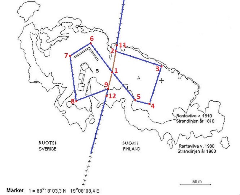
The bordermarkers on this split island are not more than a small hole in the rockstone marked by white paint, because the seasonal drift ice would shear off any protruding markers. They must have been made after the border correction in 1985.
We see two kind of markers: markers 1, 11 and 12 mark the maritime border which runs almost straight over the island.
The markers 2-9 mark the strange angles on the island. There is no number 10.
The numbering of the markers is drawn on a simple map in an article "Märketin Valtakunnan Raja" in Rajamme Vartijat nr. 5/1987. We consider this counting as official, also the Finnish topgraphic map uses this numbering. The markers on Märket themselves do not contain a number. Therefore we used a small blackboard and chalk to recognize the different markers. Without this help it's not that easy to see which picture represents which marker.
On this page I follow the border from north to south, so the numbers are not in a logical order.

|
Map In the middle marker 1 which marks the slight angle in the maritime border. Most likely this was the orignal landborder untill 1985 as well. Markers 11 (north) and 12 (south) are on the edge of the island, also indicating the maritime border. Here also begins and ends the typical winding border around the lighthouse.
|
||

|
Marker 11 Here the border reaches the island from the north, so in fact this is the first marker on the island. The strange number (you would expect #1) may be related to the maritime border numbering. A hole here, but no white paint or arrows. The two small white lines are chalk. Based on the coordinates no doubt this is #11,
|
||
|
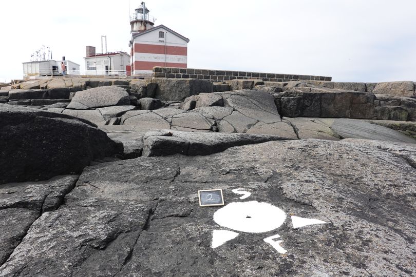
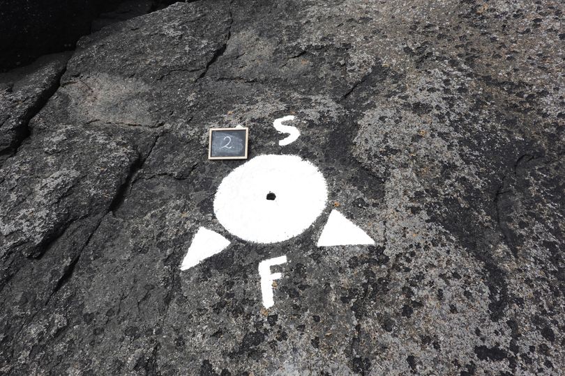
Marker 2 North-east of the lighthouse and only a few meters from #11 where the border reaches the island. It's on the east side of the island and so part of the compensation for Sweden to keep the island equally divided. Notice the small hole in the middle.
|
||

|
Marker 3 Close to the water, the border turns to the south here.
|
||

|
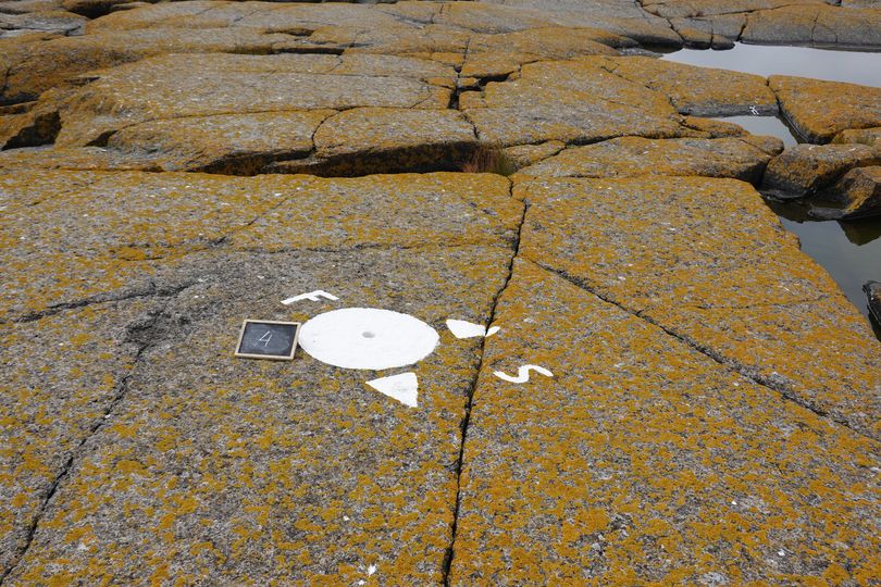
Marker 4 The border turns back to the west here. On the background two gentlemen are standing at the white spot of #5.
|
||
|
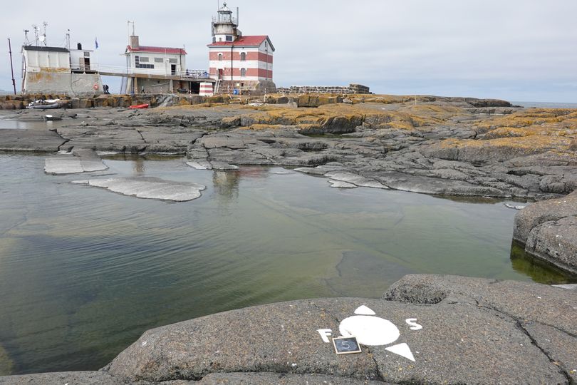
Marker 5 From here it's a straight line to #6. In the middle however is #1 which can be seen on this picture as a small white spot..
|
||
|
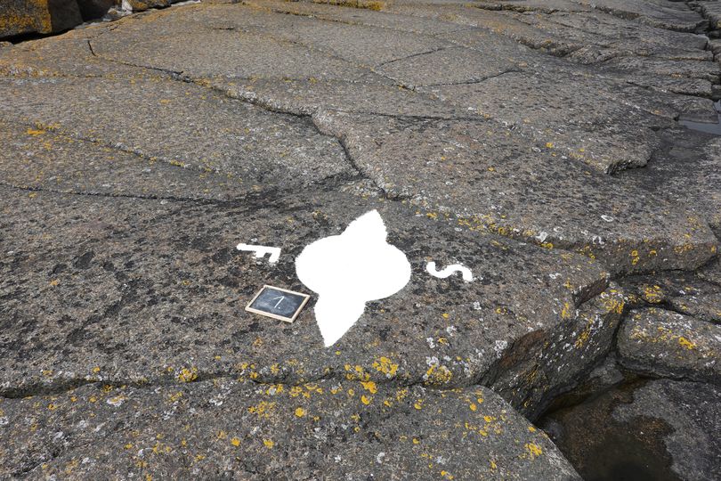
Marker 1 In the middle of the island. The arrows indicate the landborder which runs here in a straight line without a turning point. Maybe that's the reason there is no hole in the middel of the circle. The seaborder however has its turning point here.
|
||
|
Marker 6 Now we are on the Swedish part of the island where the border runs around the lighthouse.
|
||

|
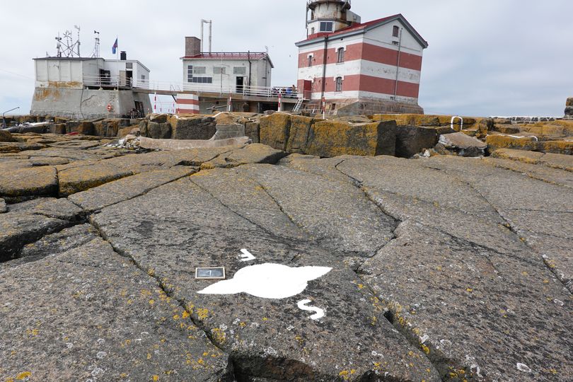
Marker 7 From here the border turns back to the middle of the island. It's the most western point of Finland.
|
||

|
Marker 8 South of the lighthouse. We had to watch out for angry seagulls approaching us very close.
|
||

|
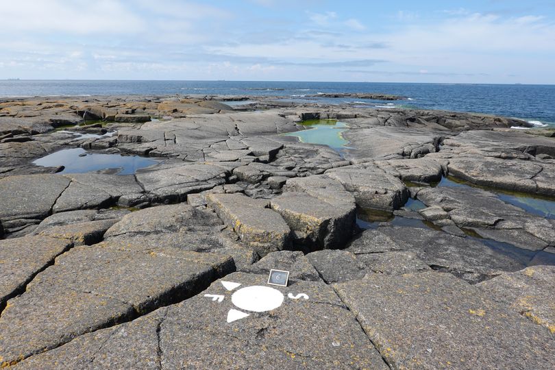
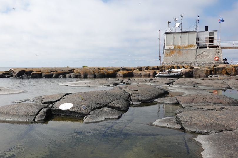
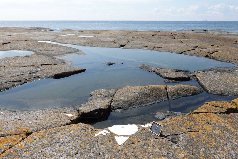
Marker 9 Mike is watching this marker with a map in his hand. Something is strange here: the arrows on the marker always indicate the straight line to the next angle. The left arrow should point at the #12. We assumed the white spot on the edge of the rock close to the water, is #12. Most likely that's not the case. It looks the border runs over the low rock to the south to the boat on the background. This boat was our boat and it was attached to a buoy. 100 to 1 this buoy is placed on the border.
|
||
|
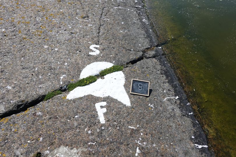
Marker 12 Most likely this is not #12 but just a white circle off the border. The arrow on #9 does not point at #12 but more to the south. Besides that, this marker has no arrows. As I first discovered it at home at not when we were on the island, the real #12 might be still waiting for us...
|


| Back to homepage | IBRG Expedition | Märket Island | Bordermarkers |